Click on the Map below to link directions with Google Maps!
Directions
*UPDATE*
There is some construction with detours near the interstate.
Be sure to use Exit 195, which is what the GPS should show anyways.
Also, the barricades are back up on N. School road (North of the entrance) like last year.
Follow the "Men's Camp" signs and you will be fine.
*The camp is gated and locked, located on a dead end road, and only accessible by crossing a private easement that is also gated and padlocked. Prior arrangements must be made for any access to the property, except during posted camp times of course. You can use the address or GPS coordinates below and copy/paste into Google Maps, Mapquest, etc.:
Google now recognizes RIVERBEND MEN'S CAMP as a destination, so you can google us, and follow google GPS directions to our entrance, or CLICK ON THE LINK BELOW, or on the map above! Or copy/paste the GPS Coordinates into your GPS! Or Print this page! You can do this!
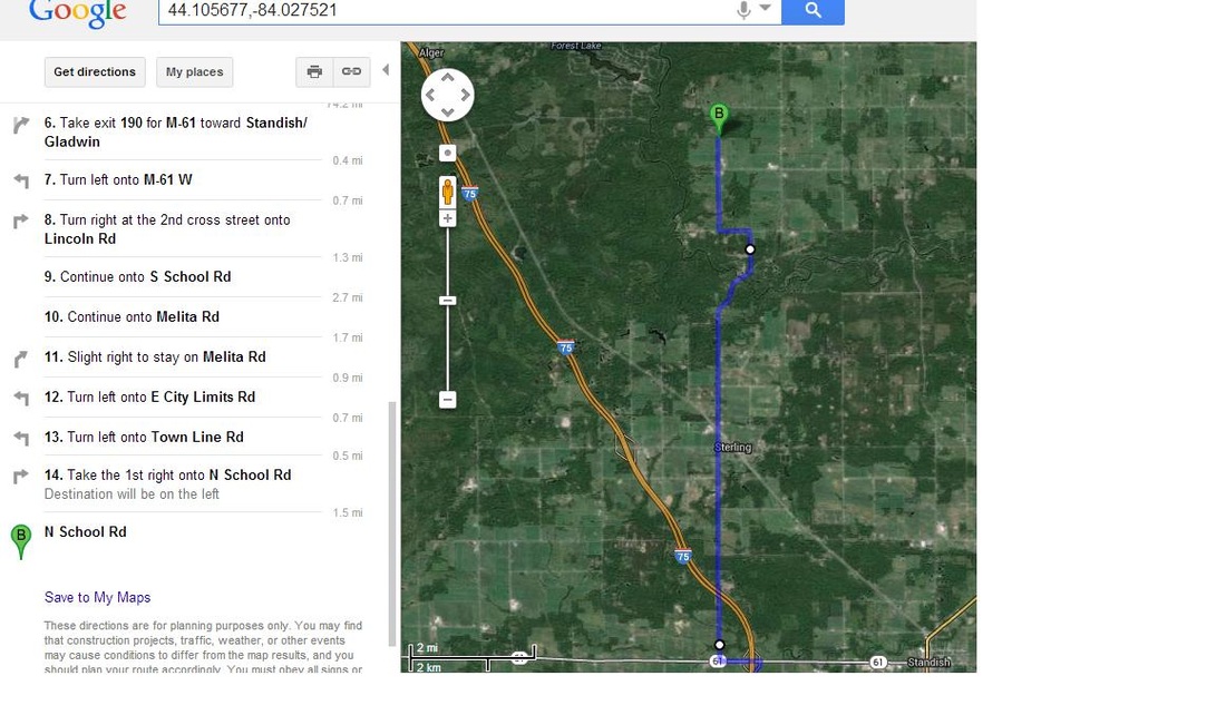
GPS Coordinates: 44.105677,-84.027521
The camp does not have an official address, but if you use 552 N. School Rd. Sterling, MI 48659, it will get you to the 'T' intersection of Bernard Rd and N. School Rd, follow Bernard (also called UnNamed Rd) it is a dirt road to camp about 1.25 miles west of tee.
Note: N. School Rd is closed north of Bernard Rd. Travel from the South on N. School and it is next 'T' Rd left after Knight Rd. Follow the signs Camp Week!
-Another method for those who do not have GPS, simply follow the signs to the River View Campground, which is on a dead end road. When you get close to that campground just start following our MEN'S CAMP signs!
Print this page and bring it with you to guide you in. Most make it, don't be one that doesn't!
-Camp is located in Arenac County approximately:
-50 miles N of Saginaw
-60 miles SE of Grayling
-140 miles NW of Detroit
-2 hours NE of Lansing
-2.5 hours NW of Bluewater Bridge, Highways 401/402 Sarnia, Ontario
-2.5 hours N of Cabela's, Dundee MI
-3 hours N of OH/MI State Line
-4 hours NE of Fort Wayne, IN
-6 hrs NE of Indianapolis, IN
GPS Coordinates: 44.105677,-84.027521 (Copy and paste into Google Maps for directions to camp entrance road)
From the south (Driving I-75 northbound):